主办单位:中国气象局沈阳大气环境研究所
国际刊号:ISSN 1673-503X
国内刊号:CN 21-1531/P

气象与环境学报 ›› 2023, Vol. 39 ›› Issue (5): 19-27.doi: 10.3969/j.issn.1673-503X.2023.05.003

• 论文 • 上一篇    下一篇

辽东湾北部海风锋与阵风锋碰撞形成的一次雷暴大风天气过程分析

蒋超1(),才奎志1,*(),杨磊1,曹世腾1,陈宇1,王一文1,班伟龙2   

  1. 1. 辽宁省气象灾害监测预警中心,辽宁沈阳 110166
    2. 沈阳市气象局,辽宁沈阳 110168
  • 收稿日期:2023-02-07 出版日期:2023-10-28 发布日期:2023-11-28
  • 通讯作者: 才奎志 E-mail:522698531@qq.com;ckz_ivan@163.com
  • 作者简介:蒋超,男,1989年生,工程师,主要从事短时天气预报预警研究,E-mail: 522698531@qq.com
  • 基金资助:
    辽宁省自然基金指导计划(2019-ZD-0855);中国气象局创新发展专项(CXFZ2022J003);环渤海区域科技协同创新基金项目(QYXM202003);辽宁省气象局关键技术项目(LNGJ201908);辽宁省气象局年度科研项目(202202);辽宁省气象局年度科研项目(202301)

Analysis of a thunderstorm gale process formed by the collision of sea breeze front and gust front in the northern Liaodong Bay

Chao JIANG1(),Kuizhi CAI1,*(),Lei YANG1,Shiteng CAO1,Yu CHEN1,Yiwen WANG1,Weilong BAN2   

  1. 1. Liaoning Meteorological Disaster Monitoring and Early Warning Center, Shenyang 110166, China
    2. Shenyang Meteorological Observatory, Shenyang 110166, China
  • Received:2023-02-07 Online:2023-10-28 Published:2023-11-28
  • Contact: Kuizhi CAI E-mail:522698531@qq.com;ckz_ivan@163.com

摘要:

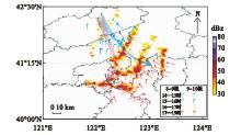
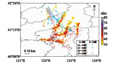
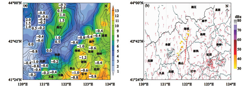
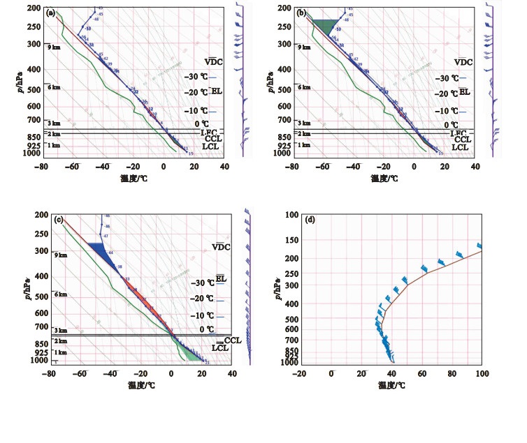
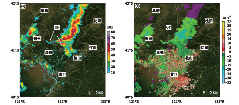
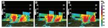
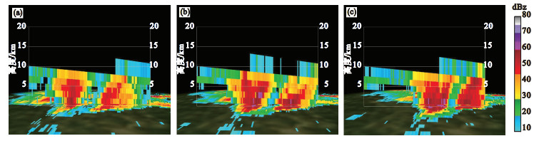
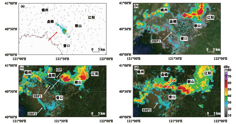
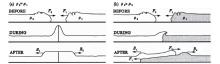
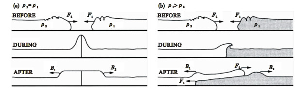
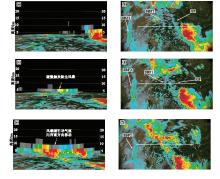
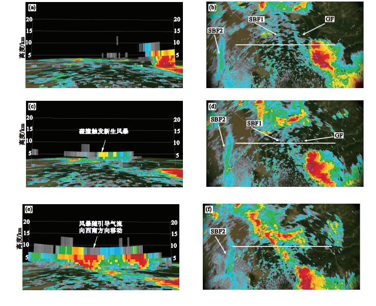
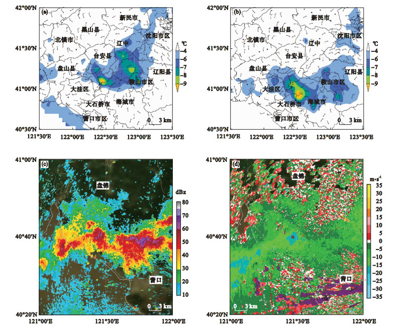
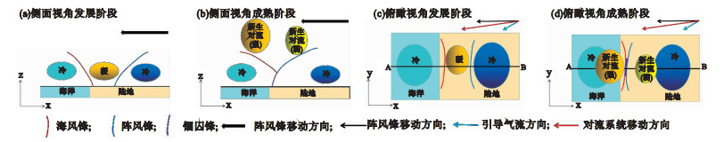
基于辽宁营口双偏振多普勒天气雷达、高空观测资料、加密自动站数据和ERA5再分析资料,对2021年5月28日辽东湾北部海风锋与阵风锋碰撞形成的一次雷暴大风天气过程进行分析。结果表明: 中尺度副冷锋南下,形成偏北风与西南海风对峙的地面辐合线,配合干线触发强对流发生。海风锋与阵风锋碰撞前,上游成熟阶段单体回波质心下沉,下沉出流促使下游单体迅速发展增强,冷池密度流在下游积云对流触发和增强起到关键作用。白天晴空辐射增温使地面温度升高,有利于对流有效位能累积,盘锦地区不稳定层结和较强的垂直风切变导致对流系统南压过程中不断发展增强。初步建立了该地区受海风锋与阵风锋正面碰撞产生雷暴大风的一类概念模型,辽东湾北部海风锋和北部南下对流产生的阵风锋碰撞,气流沿阵风锋向北爬升,对流系统在偏北引导气流的影响下,向北移动分量被抵消,向南的对流系统得以在更好的环境条件中继续发展,从而维持对流强度并影响下游地区出现雷暴大风天气。

关键词: 阵风锋, 海风锋, 碰撞

Abstract:

Based on the dual polarization Doppler weather radar high altitude observation data, encrypted automatic station data, and ERA5 reanalysis data in Yingkou of Liaoning province, a thunderstorm gale process formed by the collision of sea breeze front and gust front in the northern Liaodong Bay on May 28, 2021, was analyzed.The results show that the mesoscale sub-cold front moves southward and forms a surface convergence line that confronts the northerly wind and the southwest sea breeze, which triggers strong convection in conjunction with dryline.Before the collision between the sea breeze front and the gust front, the echo centroid of the individual in the mature stage of the upstream sinks, and the sinking outflow promotes the rapid development and enhancement of the downstream monomer.The cold pool density current plays a key role in triggering and enhancing the downstream cumulus convection.The surface temperature is increased by the daytime clear sky radiation warming, which is conducive to the accumulation of convective effective potential energy.The unstable stratification and strong vertical wind shear in the Panjin region lead to the continuous development and strengthening of the southern pressure of the convective system.A conceptual model of thunderstorms generated by the frontal collision of the sea breeze front and gust front in this area is initially established.The northern sea breeze front collides with the gust front generated by southward convection in Liaodong Bay, and the air climbs northward along the gust front.Under the influence of the northward guiding flow, the northward moving component of the convective system is canceled out, and the southward convective system continues to develop under better environmental conditions.This will maintain the strength of the convection and affect the downstream areas of thunderstorms and gales.

Key words: Gust Front, Sea Breeze Front, Collision

中图分类号: