主办单位:中国气象局沈阳大气环境研究所
国际刊号:ISSN 1673-503X
国内刊号:CN 21-1531/P

气象与环境学报 ›› 2024, Vol. 40 ›› Issue (4): 1-9.doi: 10.3969/j.issn.1673-503X.2024.04.001

• 论文 • 上一篇    下一篇

东北冷涡背景下辽宁省一次罕见暴雪过程不同阶段降雪成因分析

阎琦1,2(),谭政华1,2,苏雨萌3,霍雅姝2,李爽2,孙艺搏2   

  1. 1. 中国气象局沈阳大气环境研究所, 辽宁沈阳 110166
    2. 辽宁省气象台, 辽宁沈阳 110166
    3. 辽宁省气象信息中心, 辽宁沈阳 110166
  • 收稿日期:2023-05-30 出版日期:2024-08-28 发布日期:2024-10-11
  • 作者简介:阎琦, 女, 1974年生, 正高级工程师, 主要从事天气预报及灾害性天气研究, E-mail: yq.mete@163.com
  • 基金资助:
    中国气象局创新发展专项(CXFZ202314);中国气象局沈阳大气环境研究所联合开放基金课题(2021SYIAEKFZD03);辽宁省气象局年度基金项目(202312)

Causes analysis of snowfall during different stages of a rare heavy snowstorm event in Liaoning province under the background of Northeast Cold Vortex

Qi YAN1,2(),Zhenghua TAN1,2,Yumeng SU3,Yashu HUO2,Shuang LI2,Yibo SUN2   

  1. 1. Institute of Atmospheric Environment, China Meteorological Administration, Shenyang 110166, China
    2. Liaoning Meteorological Observatory, Shenyang 110166, China
    3. Liaoning Provincial Meteorological Information Center, Shenyang 110166, China
  • Received:2023-05-30 Online:2024-08-28 Published:2024-10-11

摘要:

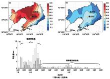
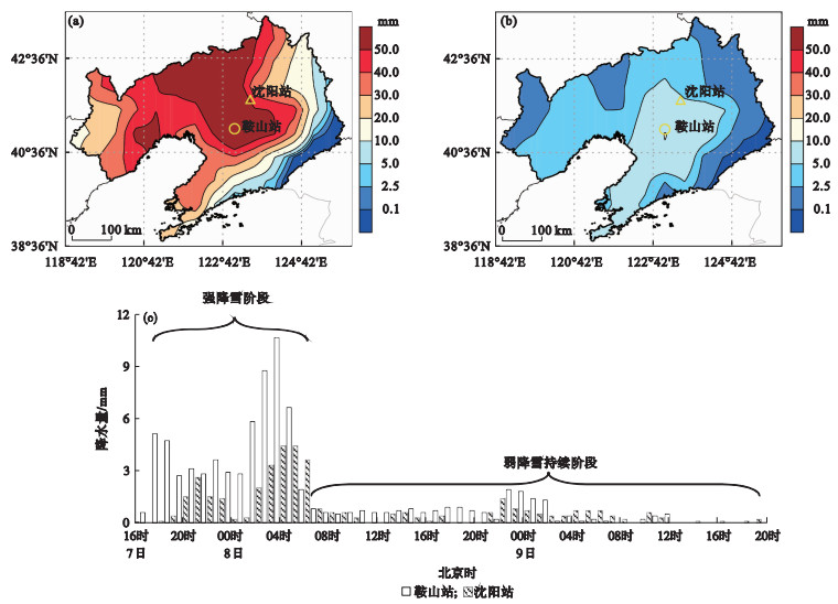
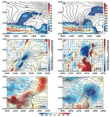
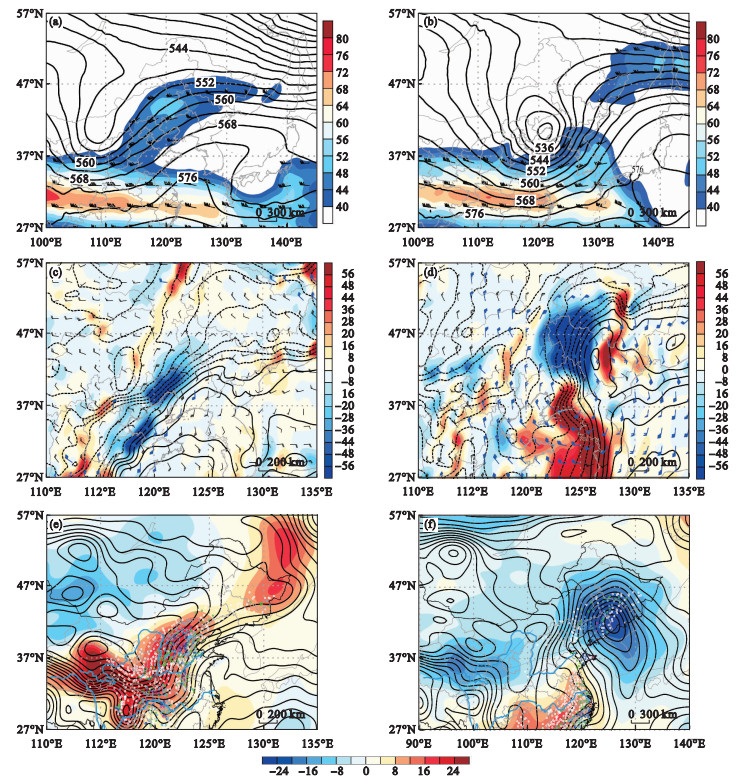
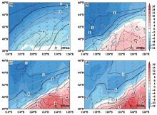
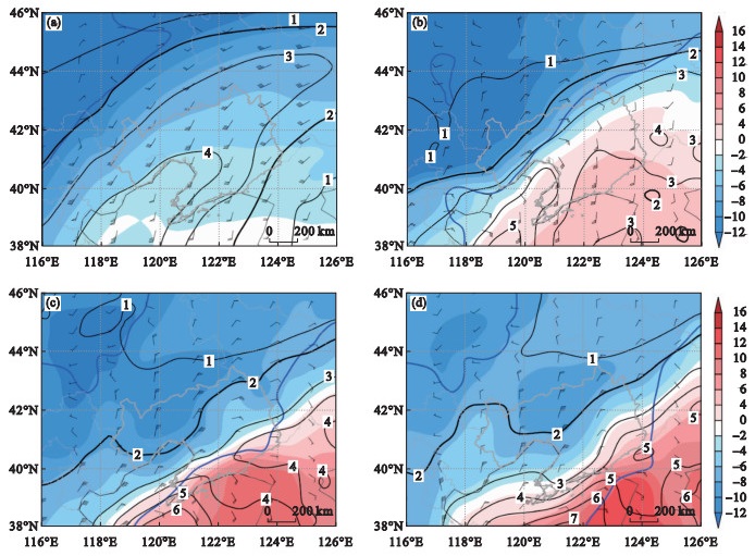
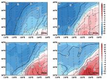
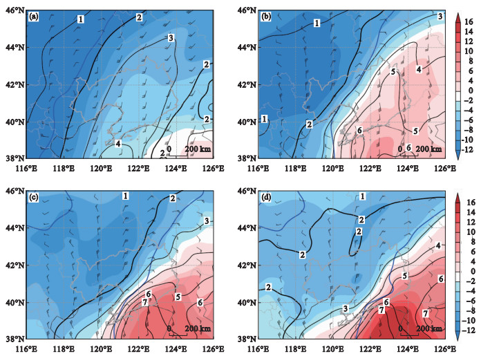
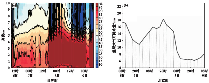
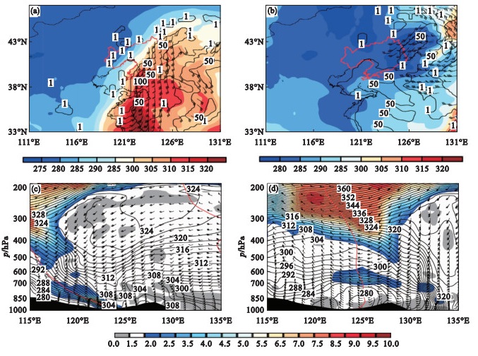
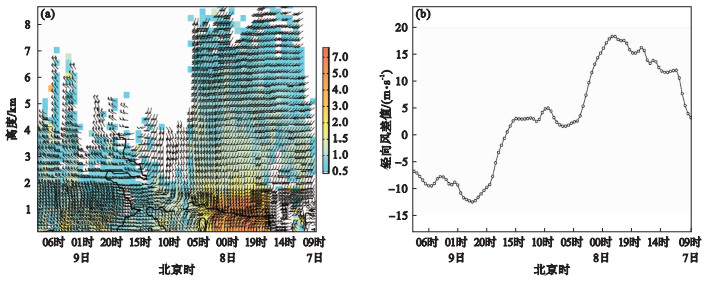
选用常规观测、降雪加密观测、风廓线雷达、微波辐射计等多源监测资料及CMA-RA再分析资料, 对2021年11月辽宁省一次罕见降雪天气过程分阶段进行水汽、热动力特征和成因分析。结果表明: 东北冷涡、地面气旋强烈发展, 南、北两支锋区相互作用, 导致吉林西部强冷平流向南输送形成冷垫, 入海气旋前部强暖平流沿冷垫爬升, 为此次降雪的大尺度环流背景; 黄海、东海为主要水汽源地。此次过程的强降雪阶段, 中层暖湿空气与低层回流冷湿空气在垂直方向上叠加形成深厚的湿层; 辽宁中部850 hPa以下对流层低层和700 hPa附近存在对流不稳定层结; 暖湿空气在925~700 hPa沿冷垫倾斜方向的锋生作用增强, 同时925 hPa以下水平风场辐合在水平方向产生锋生, 锋生动力抬升作用与东北冷涡前部上升运动叠加, 导致近地面至5 km高度出现强上升运动。弱降雪持续阶段, 干冷空气侵入、水汽条件减弱, 中层减弱的暖湿空气与低层干冷空气在垂直方向上叠加, 对称不稳定层结维持, 受东北冷涡底部多个短波槽影响, 降雪持续减弱。

关键词: 对流不稳定, 锋生作用, 暖湿空气, 多源监测

Abstract:

Utilizing conventional observations, intensified snowfall observations, wind profiler radars, microwave radiometers, and other multi-source monitoring data, as well as CMA-RA reanalysis data, a rare snowfall event in Liaoning province in November of 2021 was analyzed for its water vapor and thermodynamic characteristics and causes stage by stage. The results indicated that the strong development of the Northeast Cold Vortex (NCV) and ground cyclone, coupled with the interaction between northern and southern frontal zones, led to the southward transport of strong cold advection from western Jilin, forming a cold air cushion. The strong warm advection in front of the offshore cyclone ascended along this cold cushion, providing the large-scale circulation background for this snowfall event. The Yellow Sea and the East China Sea are the main moisture sources. During the heavy snowfall phase of this process, mid-level warm and moist air overlapped vertically with low-level returning cold and moist air, form a deep moist layer. Convectively unstable stratification existed in the lower troposphere below 850 hPa and near 700 hPa in central Liaoning province. Frontogenesis intensified along the inclined direction of the cold cushion between 925~700 hPa, at the same time horizontal wind field convergence below 925 hPa generated frontogenesis in the horizontal direction. The combination of frontogenetic dynamic lifting and ascending motion in front of the NCV resulted in strong upward motion from near-surface to approximately 5 km altitude. During the sustained weak snowfall phase, the intrusion of dry cold air and the weakening of moisture conditions, the weakened warm and moist air in the middle levels and dry and cold air in the lower levels overlapped vertically. Symmetric instability stratification persisted, and the influence of multiple short-wave troughs at the bottom of the NCV led to the continuous weakening of snowfall.

Key words: Convective instability, Frontogenesis, Warm and moist air, Multi-source monitoring

中图分类号: