主办单位:中国气象局沈阳大气环境研究所
国际刊号:ISSN 1673-503X
国内刊号:CN 21-1531/P

气象与环境学报 ›› 2022, Vol. 38 ›› Issue (3): 37-44.doi: 10.3969/j.issn.1673-503X.2022.03.005

• 论文 • 上一篇    下一篇

持续性冷涡暖锋暴雨成因及特征分析

任丽(),栾晨,王晓雪,张月   

  1. 黑龙江省气象台, 黑龙江 哈尔滨 150030
  • 收稿日期:2020-12-15 出版日期:2022-06-28 发布日期:2022-07-23
  • 作者简介:任丽, 女, 1982年生, 正研级高级工程师, 主要从事灾害性天气研究及常规天气预报, E-mail: strli@163.com
  • 基金资助:
    国家重点研发计划项目(2018YFC1507303);黑龙江省自然科学基金联合引导项目(LH2019D016);黑龙江省龙云气象科技有限责任公司气象院士工作站重点项目(YSZD201702);中国气象局预报员专项项目(CMAYBY2020-039)

Causes and characteristics of a persistent rainstorm event in warm front of a cold vortex

Li REN(),Chen LUAN,Xiao-xue WANG,Yue ZHANG   

  1. Heilongjiang Meteorological Observatory, Harbin 150030, China
  • Received:2020-12-15 Online:2022-06-28 Published:2022-07-23

摘要:

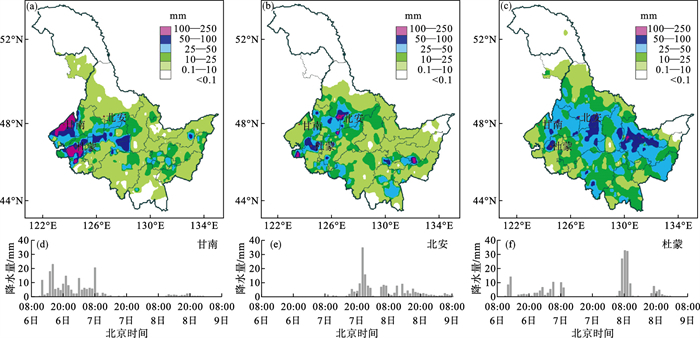
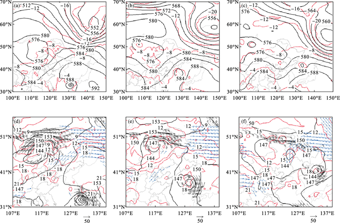
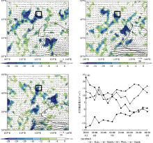
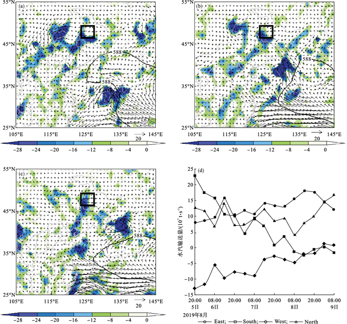
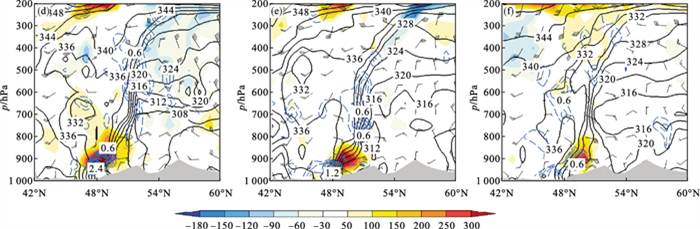
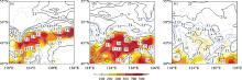
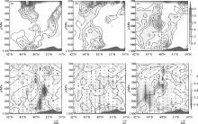
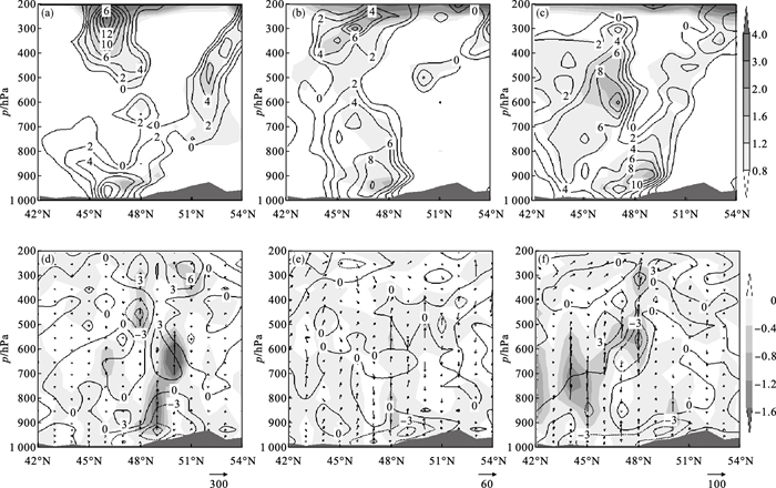
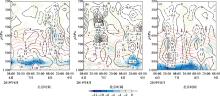
利用常规观测资料、自动气象站降水量以及NCEP FNL再分析资料, 对2019年8月6—8日一次持续性东北冷涡暴雨过程成因及特征进行诊断分析。结果表明: 暖锋稳定维持在同一区域且不断锋生造成持续性暴雨。强降水出现在850 hPa锋区南侧, 呈东西带状分布, 暴雨与最大锋生区相对应。大气中层为弱对流不稳定, 有利于强降水的维持。高层正位涡大值区向下层扩展, 促使中低层涡度增加, 在暖锋前形成正涡柱结构, 在地面锋区上诱发出气旋性环流, 有低压新生。锋区低层的强辐合区位于迎风坡, 锋面辐合抬升和地形强迫抬升的共同作用, 使低层强辐合区持续3 d维持在同一区域。冷涡东移减弱阶段, 台风携带大量暖湿空气北上促使锋区北抬, 强降水维持。冷涡新生和维持阶段, T850-500≥25 ℃, K≥35 ℃, 且有一定的对流有效位能, 对暴雨的出现有较好的指示意义。暴雨区东边界的水汽输入最为关键, 占到整个水汽输入总量的一半, 尽管南边界的总水汽输入量不大, 但集中出现在第一个暴雨日, 是6日暴雨过程主要水汽贡献者。

关键词: 东北冷涡, 台风, 暖锋, 锋生, 迎风坡

Abstract:

Based on conventional meteorological observational data, precipitation data from automatic observational stations, and National Centers for Environmental Prediction(NCEP) FNL reanalysis data, we diagnostically analyzed the causes and characteristics of a persistent rainstorm event due to a cold vortex in Northeast China from August 6 to 8, 2019.The results indicated that a warm front that remains stable and makes frontogenesis causes the persistent rainstorm event.Heavy precipitation occurs in the south of the 850 hPa front areas, with a pattern of an east-westward belt, corresponding to the maximum frontal zone.The middle-level atmosphere has weak unstable convection, which favors the maintenance of heavy precipitation.The region with a high value of positive potential vorticity in the upper layer extends down to the lower layer, leading to the increase of the vorticity in the middle and lower layers and the formation of a columnar structure of positive vorticity ahead of the warm front.Moreover, it induces cyclonic circulation in the front area near the surface and promotes the occurrence of low-pressure systems.A strong convergence zone at the low-level frontal area is located on the windward slope.The interaction of frontal convergence and topographic forced uplift makes the low-level strong convergence zone remain in the same area for 3 days.In the weakened stage of the eastward movement of the cold vortex, warm and moist air carried by a typhoon moves northward, resulting in the northward movement of the front area and the maintenance of heavy precipitation.In the stages of formation and maintenance of the cold vortex, T850-500≥25 ℃, K≥35 ℃, and a certain convective effective potential energy are a good indication of the occurrence of heavy precipitation.The water vapor input along the eastern boundary of the rainstorm area is the most critical, accounting for half of the total water vapor input.Although the total water vapor input from the southern boundary is not quite large, it concentrates in the first rainstorm day and contributes most of the water vapor for the rainstorm on August 6, 2019.

Key words: Northeast cold vortex, Typhoon, Warm front, Frontogenesis, Windward slope

中图分类号: