主办单位:中国气象局沈阳大气环境研究所
国际刊号:ISSN 1673-503X
国内刊号:CN 21-1531/P

气象与环境学报 ›› 2023, Vol. 39 ›› Issue (6): 1-9.doi: 10.3969/j.issn.1673-503X.2023.06.001

• 论文 • 上一篇    下一篇

贺兰山东麓两次暴雨过程湿位涡特征分析

王勇1,2,3(),陈豫英1,2,3,*(),李婷1,2,3,苏洋1,2,3   

  1. 1. 中国气象局旱区特色农业气象灾害监测预警与风险管理重点实验室, 宁夏银川 750002
    2. 宁夏气象防灾减灾重点实验室, 宁夏银川 750002
    3. 宁夏气象台, 宁夏银川 750002
  • 收稿日期:2023-03-27 出版日期:2023-12-28 发布日期:2024-01-27
  • 通讯作者: 陈豫英 E-mail:258971819@qq.com;chenyuy@sina.com
  • 作者简介:王勇, 男, 1989年生, 工程师, 主要从事天气预报技术与方法研究, E-mail: 258971819@qq.com
  • 基金资助:
    国家自然科学基金项目(41965001);宁夏回族自治区科技创新领军人才培养工程项目(2021GKLRLX05);宁夏回族自治区重点研发计划项目(2022BBF02014);宁夏自然科学基金项目(2023A0605);宁夏自然科学基金项目(2022AAC03672);中国气象局旱区特色农业气象灾害监测预警与风险管理重点实验室开放研究项目(CAMF-202201)

Characteristics of wet potential vortex in two rainstorms at the eastern foothills of Helan Mountains

Yong WANG1,2,3(),Yuying CHEN1,2,3,*(),Ting LI1,2,3,Yang SU1,2,3   

  1. 1. Key Laboratory for Meteorological Disaster Monitoring and Early Warning and Risk Management of Characteristic Agriculture in Arid Regions, CMA, Yinchuan 750002, China
    2. Ningxia Key Laboratory for Meteorological Disaster Prevention and Mitigation, Yinchuan 750002, China
    3. Ningxia Meteorological Observatory, Yinchuan 750002, China
  • Received:2023-03-27 Online:2023-12-28 Published:2024-01-27
  • Contact: Yuying CHEN E-mail:258971819@qq.com;chenyuy@sina.com

摘要:

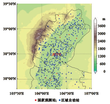
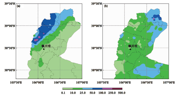
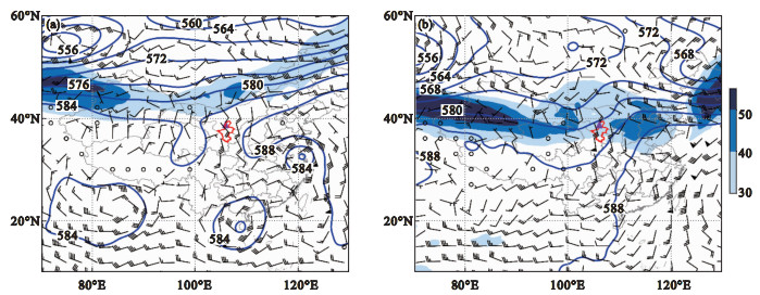
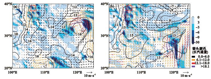
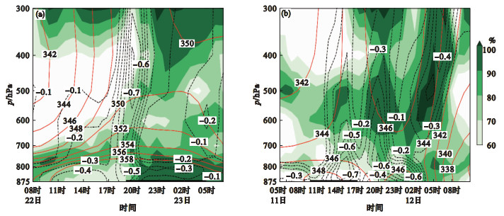
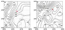
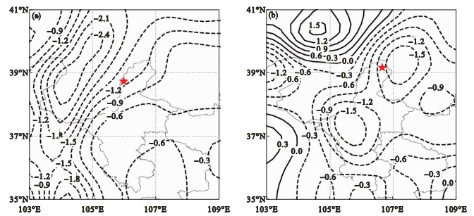
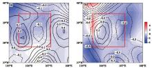
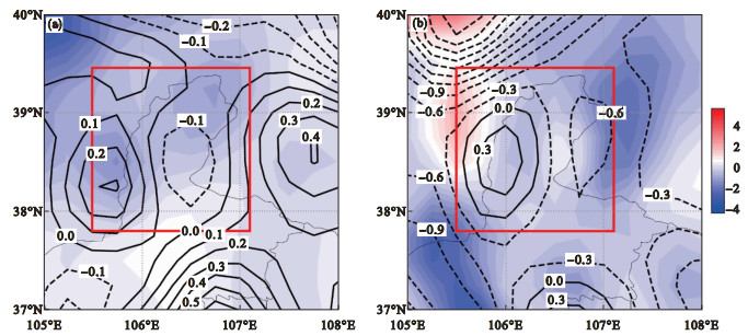
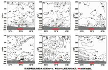
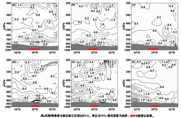
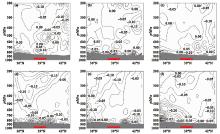
选用宁夏贺兰山东麓512个自动气象观测站逐小时降水量数据和ERA5再分析资料及常规气象探测资料, 对比分析该地区2018年7月22日特大暴雨和2020年8月11日大暴雨过程的湿位涡特征, 探讨两次暴雨发生发展机制。结果表明: 两次暴雨过程均发生在“东高西低”的环流形势下, 西太平洋副热带高压西侧的偏南气流、高低空急流配置以及台风为暴雨过程提供了有利的水汽和动力条件; 暴雨发生前3~6 h, 对流层低层700~850 hPa存在湿位涡正压项(MPV1)负值中心和湿位涡斜压项(MPV2)正负中心过渡的等值线密集带, 其移动发展及持续时间同暴雨发生发展有较好的对应, 对暴雨预报有一定指示作用。对流层低层MPV1负值区和MPV2正值区相叠加的位置是强降水易发区, 且MPV1、MPV2强度越强、持续时间越长, 降水越强, 当MPV1和MPV2趋于零时, 大气层结稳定, 降水过程逐渐结束。

关键词: 暴雨预报, 湿位涡, 强降水

Abstract:

Based on hourly precipitation data from 512 automatic meteorological observation stations at the eastern foothills of Helan Mountains in Ningxia province, the ERA5 reanalysis data, and conventional meteorological detection data, the moist potential vortex characteristics of the two extreme rainstorm events occurred on July 22, 2018, and August 11, 2020, in this region were compared and analyzed.The occurrence and development mechanism of the two rainstorm events were explored.The results show that the two extreme rainstorm processes occur under the circulation situation of "high in the east and low in the west".The southerly flow on the west side of the western Pacific Subtropical High, the configuration of high and low air jets, and the typhoon provide favorable water vapor and dynamic conditions for the heavy rainfall processes.In the lower troposphere of 700~850 hPa, 3 ~ 6 h before the rainstorm, there is a dense isocontourt zone with the transition between the negative center of the positive pressure term of the moist potential vortex (MPV1) and the positive and negative center of the moist potential vortex baroclinic term (MPV2), and its movement development and duration correspond well to the occurrence and development of the rainstorm, which can indicate the rainstorm forecast.In the lower troposphere, the position where MPV1 negative region and MPV2 positive region are superposed is an area prone to heavy rainfall, and the stronger and longer the intensity and duration of MPV1 and MPV2 are, the stronger the precipitation will be.When MPV1 and MPV2 approach zero, the atmospheric stratification will be stable and the rainfall process will gradually end.

Key words: Rainstorm forecast, Moist potential vortex, Heavy rainfall

中图分类号: